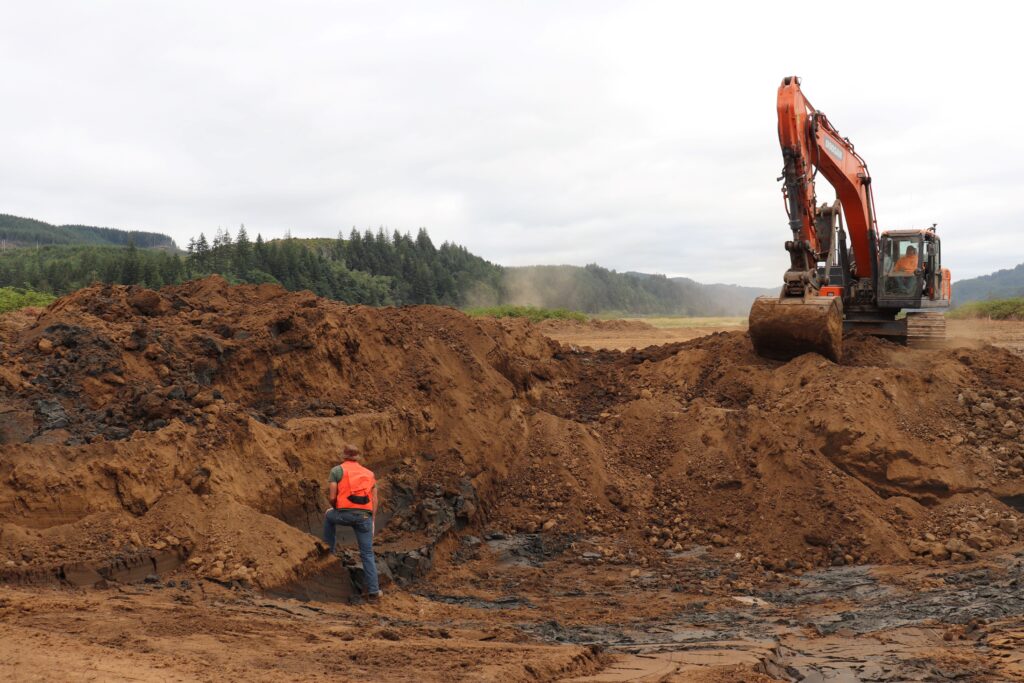
Partners from the Confederated Tribes of Coos, Lower Umpqua and Siuslaw Indians, the Siuslaw Watershed Council, and McKenzie River Trust are preparing for a second season of restoration on the Siuslaw River at Waite Ranch. Beginning in summer 2023, the tidal restoration project is working to return around 200 acres of estuarine wetlands to the Siuslaw River system.
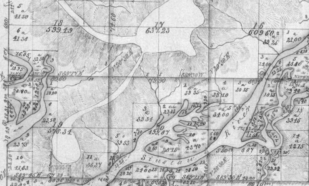
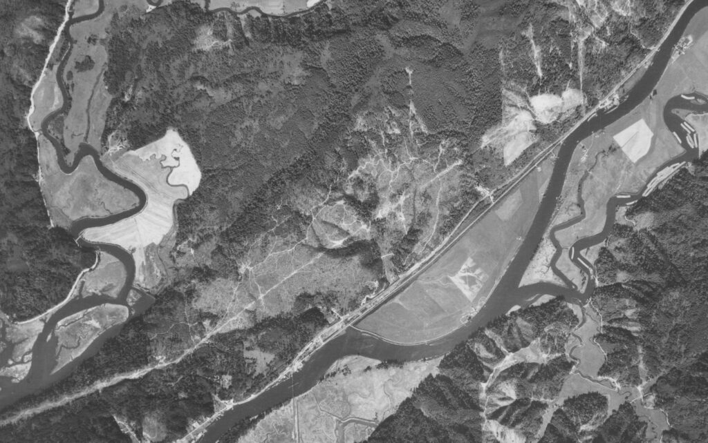
Above: a government-drawn map from the 1800s shows the estuary branching through the present-day property. Below: An aerial from the 1940s captures early conversion efforts at Waite Ranch.
The project is located 3 miles upstream of Florence, OR along Highway 126. In the 1800s, the land was converted for agriculture and used primarily for cattle ranching and dairy production. Converting tidal wetlands to agriculturally productive lands required the installation of a levee around the property to armor it from the fluctuating river. To keep farm fields dry enough for cattle, ditches were dug across the property and a simple tide gate was installed to drain the pasture. After decades of farming, the land was sinking beneath the weight of heavy cattle, and the ongoing maintenance cost for infrastructure began to overshadow its production value. In 2010, McKenzie River Trust purchased the property, which had been identified as a high conservation priority by regional partners working to address immediate threats to native Coho salmon in the system whose numbers fell from more than 450,000 adults returning to spawn annually in the early 1900s to as few as 500 by the 1990s.
Since purchasing Waite Ranch for conservation, McKenzie River Trust has worked with regional partners to design a project that meets both human and nonhuman needs. In 2023, partners began excavating the footprint for a renewed primary tidal channel on the site. Before agricultural conversion, the estuary flowed in and out of the remnant Prossler Slough, which now separates the project site from the highway. The new primary channel is being constructed further upstream from its historic location to protect the highway. Excavating a new route for water will provide a controlled re-entry point for the tidally influenced river to reconnect with its historic floodplain while keeping water away from nearby infrastructure. A muted tide gate will be installed at the mouth of Prossler Slough to regulate highway-adjacent flows while allowing for fish passage.
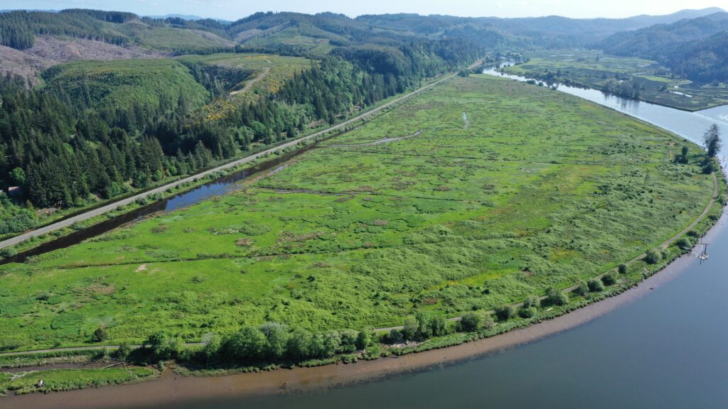
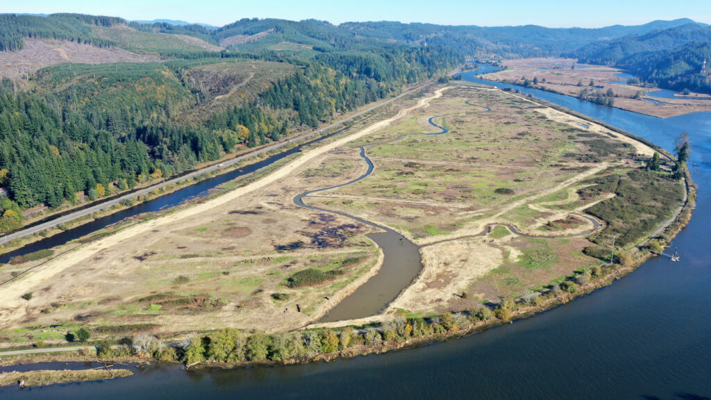
The project site seen in May 2023 (above) before project work began and again in October 2023 (below) after year one.
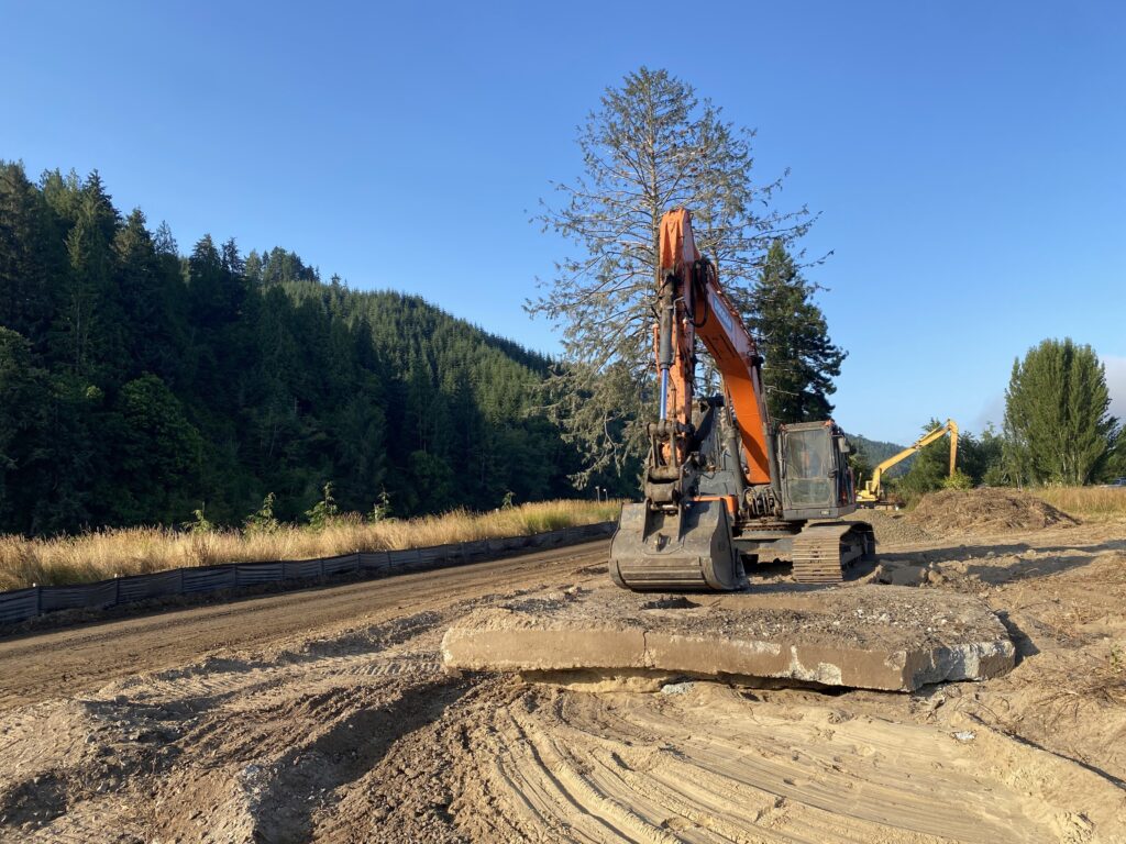
Excavators remove a concrete pad, a relic from the site’s agricultural history, in 2023.
As excavation work continues, sediments are being moved and utilized on-site to fill in remnant drainage ditches and construct a large berm between Prossler Slough and the project area. Due to years of soil compaction, additional material has been brought into the project site including fill material generated from a campground expansion at the Port of Siuslaw. In 2024, passersby can expect to observe continued soil movement as footprints for primary and secondary channels are completed. Additionally, a berm will be constructed to increase protection for Highway 126. This berm will begin to obscure the view of the project area, but it will eventually serve as an access point for ongoing maintenance of the site and educational programs conducted by project partners.
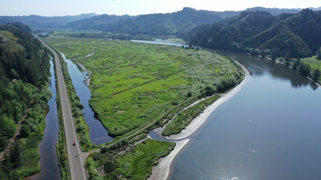
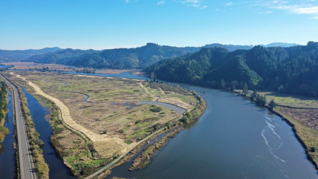
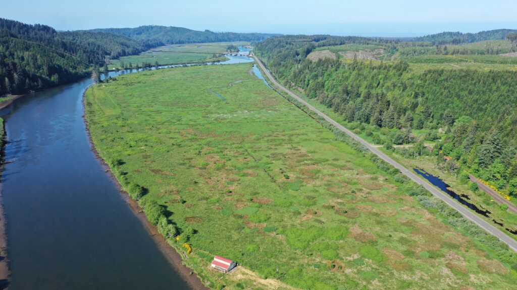
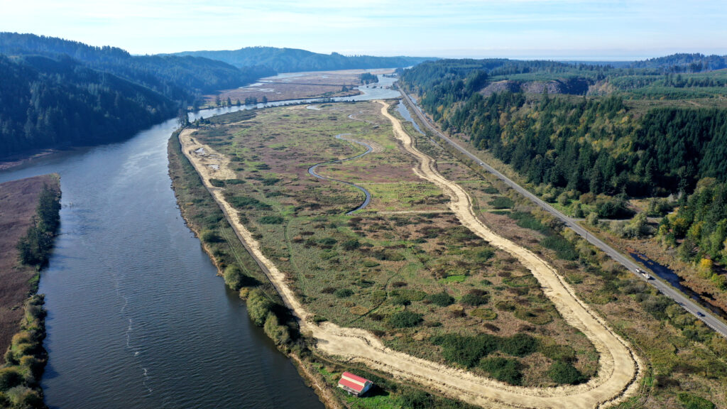
Above: looking upstream toward Mapleton, Highway 126 is seen in the left-hand side of the frame, surrounded by Prossler Slough, a remnant arm of the estuary from before the area was converted into agriculture.
Below: Looking downstream toward Florence, a serpentine berm footprint hugs the right-hand side of the project area. This berm will allow for maintenance and education access to the property while also helping to buffer Highway 126 (far right) from tidal fluctuations.
The entire restoration project is slated for completion in late summer 2025 and is funded through multiple grants including ones from the Oregon Watershed Enhancement Board, the National Fish and Wildlife Foundation, and the National Oceanic and Atmospheric Administration.
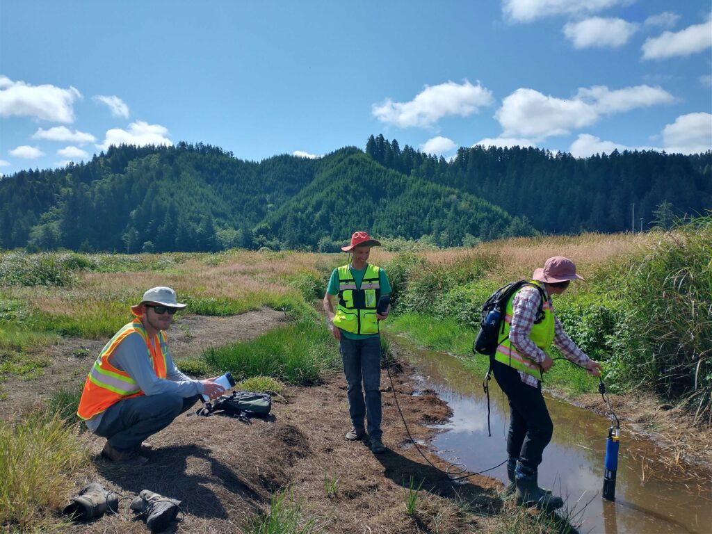
Restoration partners monitor dissolved oxygen in drainage ditches ahead of restoration in 2023.

