Floodplain Restoration Continues on Green Island
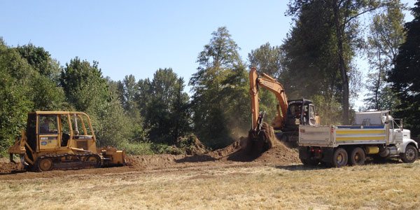
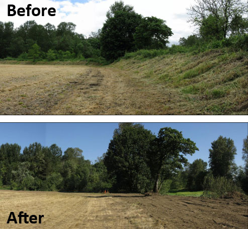
 Contractors have been hard at work on the south end of Green Island this month. Bulldozers, excavators, and large trucks removed four berms that limited the flow of high water onto the interior of the property. Within years, native grasses, incense cedar, Douglas fir, and ponderosa pine will fill an area that was once covered in blackberry vines and reed canary grass.
MRT is undertaking this work on the higher floodplain near side channels and sloughs of the Willamette River to allow for seasonal connections that have been prevented by these berms.

Active floodplains can provide many benefits to people, fish and wildlife, and they’re key to maintaining the qualities that define our Oregon landscapes. Floodplains clean water by filtering it through many layers of gravel and sediment, and they can buffer flooding impacts on downstream areas.
Floodplain side channels and sloughs also create spawning and rearing habitat for endangered salmon. Studies on Green Island completed by Oregon State University and the Oregon Department of Fish and Wildlife show that Oregon chub, Chinook salmon, and other native fish use these channels throughout many phases of their lifecycles. Floodplain forests, once abundant along the Willamette River, also harbor sensitive birds, amphibians such as red legged-frogs, and reptiles like western pond turtles.
Since 2005, MRT has been working to re-establish floodplain forest habitat for fish and wildlife by removing man-made obstructions and planting over 300 acres of Green Island with native trees, shrubs, and grasses. Local farmers, hundreds of volunteers, and dozens of local contractors have been involved in restoration efforts on the 1,000+ acre property just downstream of the confluence of the McKenzie and the Willamette rivers.
The berms removed this month were originally built 20-40 years ago to reduce flooding on farm fields. The 3,500 cubic yards of sandy loam dirt that was removed will be reused in the Coburg Aggregate Reclamation Project (CARP). The former gravel mines at CARP along the eastern edge of Green Island will also be restored to native habitat in the coming years.
In recent years, habitat restoration projects at Green Island have been supported by grants from the Bonneville Power Administration, Oregon Department of Fish and Wildlife, Oregon Watershed Enhancement Board, US Fish and Wildlife Service, and Meyer Memorial Trust. Individual donations also support our restoration efforts at Green Island and on the other properties we protect throughout western Oregon. For more information about Green Island, visit: https://mckenzieriver.org/protected-lands/owned-properties/green-island
