The Willamette Confluence was protected by The Nature Conservancy in 2010 through purchase from the Wildish Family. The purchase was supported through third-party conservation easement sales to the Bonneville Power (BPA) Administration Willamette Wildlife Mitigation Program and the Oregon Watershed Enhancement Board (OWEB). After more than a decade of restoration work, The Nature Conservancy transferred the property to McKenzie River Trust in 2023 to support the long-term care and stewardship of this special place.
An ecological crossroad where water and wildlife come together in tremendous diversity.
Where Land, Water, and People Meet
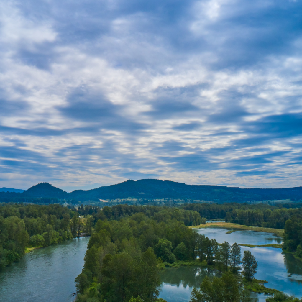
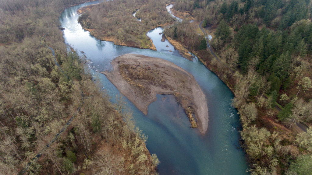
Featuring extensive habitats that are increasingly endangered in the Willamette Valley, the Willamette Confluence includes six miles of river corridor, floodplain forest, wetlands, upland oak woodlands, and native prairie. Here at the base of Mt. Pisgah, this 1,305-acre property meanders through restored gravel pits up to Oak Woodlands, providing a sanctuary for fish and wildlife in our urban backyard.
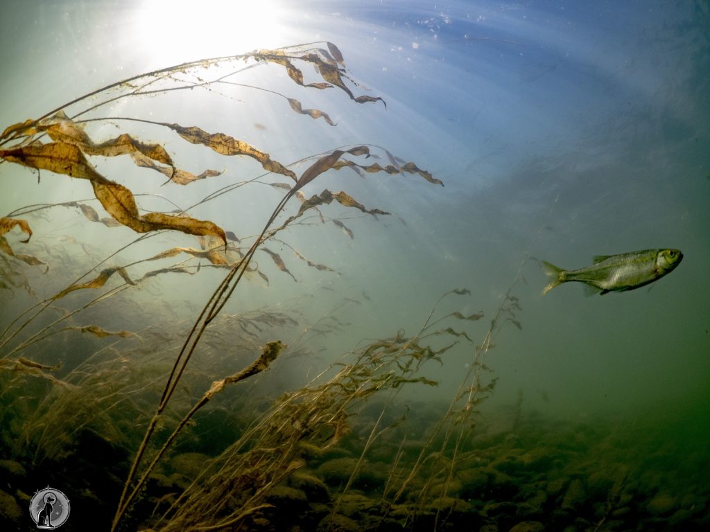
More than 30 native fish and wildlife species considered “at risk” live here including Chinook salmon, northern red-legged frog, vesper sparrow, and western meadowlark, Oregon’s state bird.
Throughout the property, a diverse array of trees and plants showcase the space between water and the upland hills that shape the Upper Willamette Valley.
In this space between urban and wild, the Willamette Confluence offers an opportunity to pause and reflect on relationships between people and place. The area is not open to the public, however, McKenzie River Trust offers many tours and volunteer opportunities throughout the year for our community to connect to this special area where the Coast Fork and Middle Fork of the Willamette Rivers meet.
Honoring a Living River
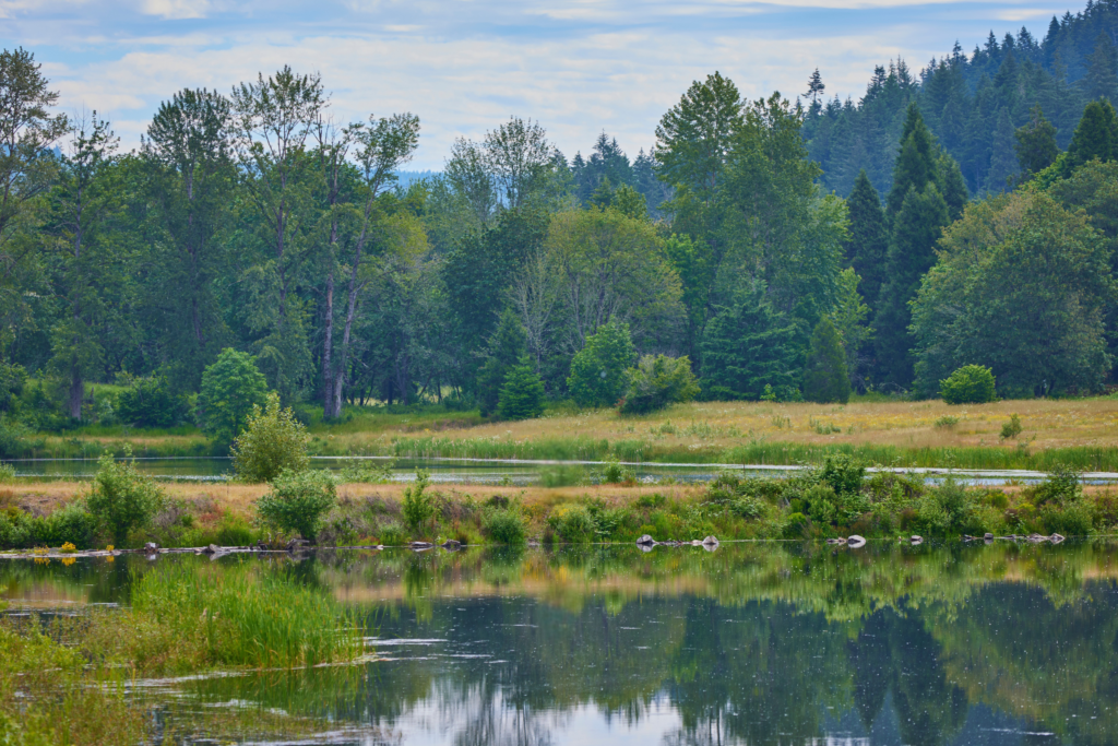
Living Rivers are dynamic and defined by interconnected floodplain habitats. Their flow volumes, their paths, their temperatures, their bed-load composition and their biota all change across seasons and across years. These dynamics produce a multitude of public benefits, including abundant clean water, rich and diverse populations of native plants, insects, birds and other animals, and opportunities for recreation.
Restoring the Willamette Confluence
Over the course of the last ten years, The Nature Conservancy has implemented restoration projects on the property to address key limiting factors for Chinook salmon, especially the widespread loss of floodplain and side-channel habitat that has occurred over the past several decades. Today, less than 15 percent of historic side channels and floodplains remain in the Willamette Basin.
The floodplain restoration project occurred in multiple phases. During the first phase, a mile of perennial side-channel was created where three former gravel pits once existed. During the second phase, seven former gravel pits were seasonally reconnected to the Coast Fork Willamette River. During the final phase, a half mile of levee and a half mile of road were removed, allowing the Middle Fork Willamette River to backwater into 80 acres of floodplain habitat.
Overall, restoration work on the Willamette Confluence has re-connected 3.5 miles of side-channel habitat and restored 630 acres of floodplain forest, improving year-round access for Chinook salmon, and improving water quality close to Oregon’s second largest metropolitan area.
In addition to floodplain restoration, The Nature Conservancy also enhanced and restored oak savanna and oak woodland habitat found on the upland slopes of the property. This work consisted primarily of removing Douglas fir and other encroaching weeds and trees. Logging took place in 2014, and seeding of native grasses and forbs occurred in 2015, with approximately 77 acres of land cared for.
As McKenzie River Trust takes over the care of this special place, we’ll continue to invest in restoration work in collaboration with community partners from across the Upper Willamette Basin.
Protecting the Willamette Confluence
The Willamette Confluence was first acquired by The Nature Conservancy in 2010 with support from the Oregon Watershed Enhancement Board (OWEB) and Bonneville Power Administration (BPA). The property is protected by two conservation easements held by each of those agencies. The conservation easements were deeded in perpetuity, for the purpose of protecting the incredible conservation values associated with the site. The Willamette Confluence is enrolled in the Willamette Wildlife Mitigation Program which provides ongoing support for the restoration and stewardship of this incredible place.
Our Partners
The long-term protection and restoration of the Willamette Confluence is made possible through partnerships ranging from federal agencies to local non-profits. Our federal partners include the Bonneville Power Administration, the US Fish and Wildlife Service, the National Marine Fisheries Service, the Army Corps of Engineers, and the USGS. State partners include the Oregon Watershed Enhancement Board, the Oregon Department of Fish and Wildlife, the Oregon Parks and Recreation District, and the Department of Geology and Mineral Industries. On a local level, we work with public partners including Lane County, Willamalane Parks District, the City of Springfield, and non-profit partners including the Friends of Buford Park & Mt. Pisgah, The Middle Fork Willamette Watershed Council, the Coast Fork Willamette Watershed Council, and Mt. Pisgah Arboretum.